

China’s industrial drone market is moving beyond airframes and flight times. Buyers now compare payload capacity, positioning accuracy, software, serviceability, and support after delivery. A compact inspection drone may suit a warehouse roof, while a heavier platform can carry thermal cameras across a wind farm. Small details matter. Battery swaps, stable video links, and clear maintenance records can shape daily operations more than a headline specification.
Robotics researcher Vijay Kumar’s work on aerial robotics offers a useful principle, paraphrased here rather than presented as a verbatim quotation: “Autonomy matters when it solves a real operational problem.” That is a practical lens for evaluating China’s manufacturers in 2026. This guide considers how companies build for inspection, surveying, agriculture, mapping, and emergency response. It also looks at payload options, flight-control systems, production experience, technical documentation, and customer support. A polished demo is not enough.
The “top 10” label should not be treated as a universal verdict. Rankings can shift with product updates, regional service, and the needs of each buyer. Some manufacturers publish detailed specifications; others leave important questions unanswered. That gap deserves attention. Readers should verify current model availability, test equipment in relevant conditions, and compare total operating costs—not just purchase prices. The result is a more grounded shortlist of Industrial Drone manufacturers, with room for uncertainty where public evidence remains limited.
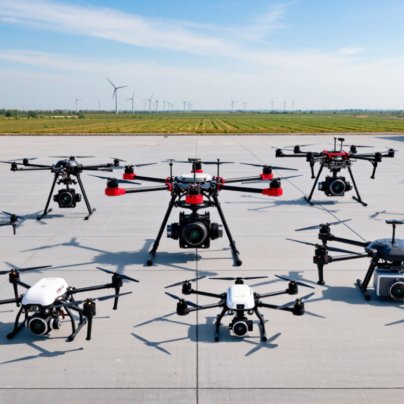
An industrial drone manufacturer in China is defined by more than an airframe. It must build aircraft for repeated work in settings such as construction sites, farms, and power corridors. That means integrating payloads, flight-control systems, batteries, and ground software into a dependable platform. Field conditions are messy. Dust, wind, and frequent battery changes can expose weaknesses that a showroom demonstration will not.
The CAAC’s 2023 Statistical Bulletin recorded more than 1.26 million registered civilian unmanned aircraft in China. This shows the scale of the operating base, but it does not measure industrial reliability or manufacturing quality.
Buyers should look for traceable production records, documented endurance and environmental tests, payload compatibility data, and accessible repair support. A manufacturer should also explain how it handles software updates and replacement parts over a product’s service life.
These details matter. Still, test results cannot fully predict performance at every worksite; even a carefully specified aircraft may need adjustments after real-world trials.
In a credible 2026 ranking, manufacturers should be assessed against documented industrial performance, not promotional claims. The review should define use cases, such as mapping, inspection, or precision spraying. Then compare payload capacity, flight endurance, navigation stability, and data quality under similar conditions. Evidence matters. Reviewers can examine test reports, maintenance records, and customer deployments, while checking whether results are independently verifiable.
A practical score might assign 30% to reliability and safety systems, and 25% to mission performance. Service and spare-parts access could receive 20%, technical support 15%, and manufacturing consistency 10%. Weights should be published. Claims should be checked against operating logs, repair turnaround times, and technician availability. No scoring model is perfect; weather, site conditions, and operator skill still affect results. Ranking differences should reflect evidence quality, not tiny spec-sheet advantages.
China’s industrial drone leaders in 2026 are best judged by capability, not by a single ranking. The strongest manufacturers combine dependable airframes, flight-control systems, imaging payloads, and practical maintenance support. Their aircraft serve surveying, power-line inspection, precision agriculture, emergency mapping, and industrial site monitoring. Buyers should compare flight endurance, payload compatibility, weather tolerance, data handling, and repair access rather than relying on headline range alone. Small details matter. A well-stocked parts channel can save a field team hours.
Leadership also varies by application. Some companies stand out in compact multirotor platforms for close inspection, while others focus on longer-range fixed-wing systems for broad-area mapping. Manufacturers with consistent production, trained service teams, and clear technical documentation are often more dependable partners than firms competing on specifications alone. Public market rankings can be difficult to verify, so claims about a definitive top ten deserve caution. Even mature aircraft have trade-offs: wind can shorten useful flight time, and complex software may slow field workflows. That is not a fatal flaw, but it should be tested before purchase.
Industrial drone makers differ most in the trade-offs between flight time, hover control, and payload capacity. Multirotor aircraft can hold position beside a tower or conveyor, but usually cover less ground per battery. Fixed-wing models survey long corridors efficiently, though they need suitable launch and landing areas. Hybrid vertical-takeoff aircraft combine both approaches, with added mechanical complexity. A specification sheet can mislead.
Payload choices shape the work. Thermal cameras reveal heat patterns on roofs and electrical equipment; LiDAR sensors capture dense geometry beneath tree cover. Multispectral cameras support crop assessment, while high-resolution RGB cameras suit visual inspection. Buyers should compare payload weight, calibration needs, and usable data—not just advertised resolution. Small details matter: a stabilized camera can produce clearer imagery during gusts.
Software is another dividing line. Some platforms focus on flight planning and obstacle awareness; others add photogrammetry, asset tracking, or fleet management. Drone Industry Insights’ 2024 Drone Market Report estimates the overall drone market will grow from about $30.6 billion in 2023 to $54.6 billion by 2030. That figure covers more than industrial aircraft, so it should not be read as a factory-drone forecast. In practical evaluations, test the full workflow: flight, data transfer, processing, and export. Software compatibility is often overlooked. It can become the frustrating part.
Industrial drone systems serve very different work sites. Utilities inspect power lines with zoom cameras and thermal sensors, looking for damaged fittings or hot spots. Construction and mining teams use aerial maps to track earthmoving, stockpiles, and site changes. PwC’s 2016 report, Clarity from Above, estimated that drone-powered solutions could create $45.2 billion in value for infrastructure. That figure describes potential value, not guaranteed savings. Important distinction.
Agriculture uses multispectral imagery to identify uneven crop growth and guide field checks. MarketsandMarkets estimated the agricultural drone market at $1.7 billion in 2023, with a forecast of $5.7 billion by 2028. Warehousing and logistics operators also use indoor drones for inventory checks, while energy companies inspect large solar and wind installations. Small details matter. A clear image is not automatically a useful decision: operators still need reliable data, trained staff, and repeatable workflows. Rain, wind, battery limits, and poor lighting can disrupt a survey. A tidy map may miss what matters on the ground.
An industry-use overview of ten industrial drone system categories and the sectors that commonly deploy them.
| No. | Industrial Drone System Category | Industries Commonly Served | Typical Workflows | Common Payloads or Sensors | Key Deployment Considerations |
|---|---|---|---|---|---|
| 1 | Multirotor inspection systems | Power generation, utilities, oil and gas, construction | Close visual inspection of towers, substations, façades, tanks, and other structures | High-resolution RGB cameras; thermal cameras where heat patterns are relevant | Shorter flight endurance than many fixed-wing platforms; operators must plan for obstacles, wind, and safe stand-off distances |
| 2 | Fixed-wing mapping systems | Agriculture, forestry, mining, land surveying, environmental monitoring | Covering large areas to create orthomosaics, elevation models, and vegetation maps | RGB mapping cameras; multispectral sensors for vegetation analysis; survey-grade positioning options | Needs suitable launch and recovery space; mapping accuracy depends on flight planning, sensor calibration, and ground control or positioning workflow |
| 3 | Hybrid VTOL mapping systems | Infrastructure, mining, utilities, agriculture, remote-area surveying | Mapping sites where runway-style launch and landing areas are unavailable | RGB, multispectral, or LiDAR payloads, depending on the survey task | Combines vertical takeoff and landing with efficient forward flight; payload, endurance, and wind limits vary by airframe |
| 4 | LiDAR survey systems | Forestry, power transmission, mining, civil engineering, infrastructure | Generating three-dimensional point clouds for terrain, vegetation, and asset modeling | LiDAR sensor, inertial measurement unit, and positioning system | Deliverable quality depends on sensor configuration, trajectory processing, control data, and the required accuracy standard |
| 5 | Thermal inspection systems | Solar energy, electrical utilities, building inspection, industrial facilities | Locating thermal anomalies in photovoltaic arrays, electrical equipment, and building envelopes | Radiometric thermal camera, often paired with an RGB camera | Results are affected by weather, surface emissivity, viewing angle, equipment load, and inspection procedure |
| 6 | Confined-space and indoor inspection systems | Manufacturing, energy, water treatment, marine, civil infrastructure | Inspecting tanks, boilers, ducts, tunnels, and other spaces that are difficult or hazardous to access | Compact visual cameras; lighting; optional thermal or gas-sensing payloads when suitable | GPS may be unavailable indoors; collision protection, communications, access controls, and confined-space safety procedures matter |
| 7 | Tethered aerial monitoring systems | Construction, public safety, energy sites, temporary industrial operations | Providing persistent aerial observation or communications support from a fixed operating location | Visible-light and thermal cameras; communications equipment, depending on the mission | Flight duration can be supported by a ground power connection, but operating radius, tether management, weather, and site permissions constrain use |
| 8 | Agricultural application systems | Crop production, forestry management, agricultural contracting | Targeted spraying or spreading, and in some workflows crop monitoring | Spray or spreading equipment; RGB or multispectral sensors for monitoring missions | Payload and application rates vary by model; use must follow local pesticide, aviation, environmental, and operator rules |
| 9 | Heavy-payload lifting systems | Construction, utilities, remote industrial sites, emergency logistics | Moving tools, cables, or supplies to locations where ground access is difficult | Load-release or winch equipment; payload-specific attachment systems | Useful payload and range are limited by aircraft configuration, battery, wind, and safety margins; lift operations need controlled ground zones |
| 10 | Long-range monitoring systems | Railways, pipelines, power networks, coastal and environmental management | Patrol surveys, route observation, and repeat monitoring over extended linear or remote areas | RGB or thermal cameras; other sensors selected for the inspection objective | Beyond-visual-line-of-sight operations require applicable approvals and risk controls; communications coverage and airspace coordination are essential |
Scope note: This table compares industrial system categories, not ten ranked or named manufacturers. Actual capabilities, payload limits, accuracy, endurance, and regulatory permissions vary by model, configuration, operating conditions, and jurisdiction.
Contact Us
Pemamek Ltd